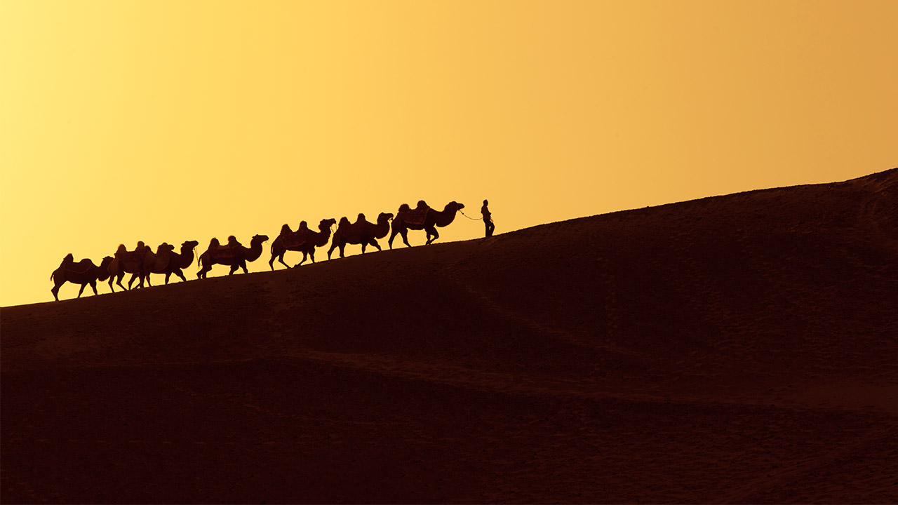
Silk Road
The Arabs and the Arabs world was the link in between West and East, and because of Arabs travelers and geographers roads was well known.
SISU News Center, Office of Communications and Public Affairs
Tel : +86 (21) 3537 2378
Email : news@shisu.edu.cn
Address :550 Dalian Road (W), Shanghai 200083, China
26 January 2017 | By Boris LOPATINSKY (w1213@shisu.edu.cn) | Copyedited by Gu Yiqing
Silk Road
The Arabs and the Arabs world was the link in between West and East, and because of Arabs travelers and geographers roads was well known.
[Abstract]
As we can observe today, the commercial routes were one of the most important issues between the 14th and 16th centuries. During that time, most of the West nations try to open new roads, searching to find other way for optimized their business goal. If the ground road, known as the “Silk Road” was useful, for most of the new power it was insecure and too much time consuming for make exchange viable, on long terms. The sea route seems then to be the best solution. We know that development of ships, help to develop new commercials route. But if everything’s seems to be working well, commercial road was depending on the good relationships in between nation; the Arabic peninsula was at that time the most valuable way, for commerce, to keep going. The Arabs and the Arabs world was the link in between West and East, and because of Arabs travelers and geographers roads was well known. This communication insisted on this aspect of the maritime route, the exchange in between East and West culture and how Arabic famous travelers open and fixed the problems of the route, by mixing efficient map using poetry and the new tools of navigation.
[About the Author]
Boris LOPATINSKY is a French scholar of international relations at Shanghai International Studies Univresity (SISU) for five years. He works at SISU's School of Asian and African Studies as a foreign expert for five year. Specialist of war and history, his research focus is on the defense concept in international law, politics and history. At SISU, he teaches history and research methodology. He takes a particular interest in oblivion, supply line, commercial road, siege and territorial issues at all historical stage.
Using Historical and Cultural Background for Creating a New Way of Communication in International Relations: The Case of the 'One Belt, One Road' Policy between Middle-East and China
|
T |
he process of discovery of new lands depends first of all on land routes, most of which are often linked to international relations of the time, so that two nations in war could completely block the transport and the trade, delaying the transmission of technologies, as well as the passage of men and goods. Therefore, it is certain that restrictions on land routes are often more related to human will than technical or technological problems. But sometimes even human will is not free, since it depends on politics or diplomacy. In fact, we could easily make such a conclusion: the only obstacle of land routes circulation is politics.
Different from land routes, sea routes, which are also the second type of travel route, are directly linked to technical progress, such as astrolabe, compass, navigation, training of crews, and of course, size of the fleet for discovering new horizons. These inventions and conditions are quite important and they show clearly that only technology decides distances that the ships can cross with an acceptable risk.
However, if men and boats are essential to the success of adventures, recognizing the path to the destination is also necessary. China, or more broadly speaking, the Far East, remained for a long time mythical and land of wealth, just like the Pillars of Hercules or Atlantis in their time.
The adventure that we will talk about is primarily an adventure from West to East. The history that we will try to understand is primarily a history of men and ships, and especially a history of poems helping to reveal the reality behind legends and allowing to create the beginning of the belt which connects henceforth West and Asia.
I) Since When the Route?
History tells us that China was known for a long time by Greeks of Bactria and Hindu Kush[1], and also by Romans[2] who traded with it. However, we have to wait until the middle of the second century AD to see the designation of this country or that of its people. It was Ptolemy[3] who gave the terms of Sinae or Thinae and who opposed them to Seres. But his idea was not very clear because in his geography, he indicates that Seres are located in the middle of China and Sinae is the name of people living in the east and along the sea. For J. Reinaud[4], there is no doubt that these two words indicate the same people. His opinion comes from S. Julien[5], but also from J. Klaporth[6]. Therefore, the Arab world discovered China thanks to Ptolemy, as A. Maury[7] and J. Brutton[8] tell us. Thus, we note that it is around the ninth century that Ptolemy’s book was translated in Arabic with the request of the Abbasid Caliph al-ʿabbās al-maʾmū[9]. This important translation allowed other Arab geographers to improve their works[10].
II) Rutter and Portulan
If geography made progress since the ninth century, we have to wait for the thirteenth century to find a cartographic representation of Ptolemy’s world drawn by M. Planudes[11]. Strangely, it seemed that Arab geographers and travellers have never thought of making a map for Ptolemy’s world. Actually, we ask this question because it was thanks to Arabs that Europeans could rediscover Ptolemy. For geographers, it’s easy to understand: they were more interested in texts and stories; but what about travellers? Don’t they need landmarks and guidance to go to their destinations?
In fact, if some travellers can return back from their adventure, it is largely due to the experience acquired during their travels. Useful information is compiled in a book called "rutter"[12] which provides not only clear and precise landmarks[13], but also possible dangers during the trip. This system mainly related to the navigation cabotage was later replaced by the first chart, namely "portulan"[14].
Arabic "rutter" is often written in rhymed poem in order to facilitate memorization of routes; all the Exempla well conserved concern the area of the Red Sea and the Indian Ocean[15].
III) Poems and Tales
However, "rutter" can also take another form than poem. Before “poem rutter”, we find some tales telling about trips to faraway places and describing the Far East. One example is the tale named Sinbad the Land Route Adventurer[16]. Another example: Sinbad the Sailor[17], tale as famous as the first one.
Sindbad al-Hakim comes from a collection of Persian tales known as The Book of Seven Viziers. The text appears to be dated from 11th century, as Bogdanovic says in postface of his translation[18]. Before this date, around the 10th century, al-Mascudf mentioned an Arabic version coming from Pahlavi. It’s almost impossible to know if it was translated or adapted. The text tells the story of Sindbad al-Hakim, who is accused by one of his father's wives of having attempted to seduce her; he is condemned to death, but the king's seven viziers take turns to delay the execution one day after another by telling stories which show the perfidy of women. Each evening, the guilty wife also tells the king a contrary story to destroy their work. After seven days, the prince Sindbad is finally permitted to speak again. He defends himself, proves his innocence, and then pardons his accuser. B. E. Perry[19] has contested the Indian origin of this theme. His opinion is accepted by the majority of specialists. If we cannot be sure about it, at least we know that the text was translated in Spain[20] in 1253 with such a title: Libra des los engannos y los assayamientos de las mujeres. Other translations are also available: a few Persians versions, some in Turkish, some in Malay language and in Syriac. After all, the Arabic versions are the most numerous[21].
Almost everyone knows Sinbad the Sailor; but fewer people know Sinbad al-Hakim’s adventures. Even a great part of his trip is on the land, its last third goes in the air and on the sea and there is nothing surprising. Actually, the author uses ellipse, a literary device, to avoid all the roads that readers already know very well by travelers’ stories. So the last third of Sinbad al-Hakim’s trip is on the sea, and his destination is the country of waq waq, the country of Amazons, and the country of djinns. There is no doubt that this part concerns Japan, since Sindbad al-Hakim has already left the kingdom of China. The description of his travel to the country or waq waq and his arrival at the port provides a quite precise route from China to Japan. This well-known route is confirmed by Rashid-Eddin, Persian- Mongolian historian, in his book Djema 'ettawarikh (1294), in which Japan is named Djemen Kou[22].
Rachid-Eddin’s interest in the Far East is in fact easy to understand because when he wrote his book, Arab world had just met Mongols[23]. If we are sure to date first land route contacts up to around the ninth century, maritime route contacts take a little more time. The earliest maritime contacts could take place in the year one thousand, and at the latest in the eleventh century, as artefacts of the city of Quanzhou in Fujian attest[24].
Conclusion
The corpus of texts related to communication and exchange between the two worlds is particularly important for the Arab world. The question of “rutter” demands more research and its values wait for more consideration. If al-Hakim is rewarded for his exploits with a beautiful new name, Sindbad, it is not appropriate to call him “Land Route Adventurer”, since the most important part of his trip, that is to say the last third, takes place in the air and on the sea. Maybe we should just call him “Sindbad al-Hakim the persistent” in view of his constant love for his wife, for whom he goes through so many dangers on the land, in the air and on the sea.
Last but not least, since every story has an end, “Sindbad al-Hakim the persistent” might be the first one to connect the West and the East by navigation, which would be practiced by both Arabs and Europeans later. Therefore, the first part of the belt was finished; and today, it is China’s turn to buckle the belt and to show its willingness to communicate with the whole world.
[1] At the beginning, Bactria was a part of Hindu Kush, quick after the collapse of Alexander Empire, Hindu Kush is only mention as the mountain chain at East of Afghanistan. It’s in this location, that it was describe by Ibn BATOUTAH, Voyages, Trad. M. Defrémery, Paris, 1848, vol. I, p. 156, ainsi : « il y a au milieu de la route une montagne nommée Hindou-Kouch, c'est-à-dire qui tue les Hindous, parce que beaucoup d'entre les esclaves mâles et femelles que l'on emmène de l'Inde meurent dans cette montagne à cause de la violence du froid et de la quantité de la neige ».
[2] About the reference system for antic texts we decide to just mention the classical references as books, chapters or part, this for avoid the difficult choice of edition, and make easier to find the passage in texts. For Greek author cf. Strabo (Στραβων), lib. XV, Chap. I, XXV et XXVIII. For Latin writers, who are much more prolific about China, we refer to: Publius Virgilius Maro, Georgus, lib. I, Ode XII : Ad Caesarem Augustum ; lib. I, Ode XXIX, Ad Iccium ; lib. III, Ode XXX, Ad Mascenatem. Pomponius Mela, De Situ Orbis, lib. I, cap. II et lib. III cap. VII. Caius Plinus secundus, Naturalis Historia, lib. VI, XX ; lib XII, I ; lib XII, XLI. Annaeus Florus, Epitoma de Tito Livio, lib. IV, XII. Ammianus Marcellinus, Res gestae, lib. XII, VI.
[3] Concerning the known cartography representation of Ptolemy, see the book of Jerry BROTTON, A History of the world in twelve maps, London, 2012. About the geographic zone, include China cf. Germaine AULAC, « Claude Ptolémée, astronome, astrologue géographe. Connaissance et représentation du monde habité », Comité des travaux historiques et scientifiques, Paris, 1993, p. 428.
[4] Joseph. REINAUD, Relations politiques et commerciale de l’Empire romain avec l’Asie orientale ; Hyrcanie, Inde, Bactriane et la Chine, Paris, 1863 p. 44.
[5] Stanislas JULIEN, Réponse mesurée de M. Stanislas Julien à un libellé injurieux de M. Reinaud, Paris, 1859, p. 6 ; 9-16.
[6] Julius KLAPROTH, Mémoires relatifs à l’Asie, t. III, p. 266, Klaproth characterise the name of Chinese people.
[7] Alfred MAURY, « Examen de certains points de l’itinéraire que les Arabes et les Persans suivaient pour aller en Chine », in Extrait du bulletin de la société de géographie, Paris 1846, p. 4, for the geographer list. About the analyse see A. PAUCHONT, « Une ligne de navigation chinoise au IXe siècle », Revue Indochinoise, Paris, 1904, p. 49-57.
[8] Jerry BROTTON, cf. note 2, p. 60-66.
[9] The Encyclopaedia of Islam, Leiden, 1986, vol. I, p. 11-12 ; بو العباس المأمون عبد الله بن هارون الرشيد. Abreviated : EI.
[10] We mentioned as example Abu'l Qasim Ubaid'Allah ibn Khordadbeh (ابوالقاسم عبیدالله ابن خردادب), EI., vol. V, Kitâb al-Masâlik wa'l-Mamâlik (Liber Viarum et Regnorum) Auctore Abu'l-Kâsim Obaidallah ibn Abdallah Ibn Khordâdhbeh et excerpta e Kitâb al-Kharâdj auctore Kodania ibn Dja'far quae cum versione gallica edidit, indicibus et glossario instruxit M. J. de Goeje. — Lugduni— Batavorum, apud E.J. Brill. 1889, in-8,pp. XXIII-216 + texte arabe, pp. 308 ; Abû `Abd Allah Muhammad ben Mūsā al-Khawārizmī (بو عبد الله محمد بن موسى الخوارزمي), EI., vol. IV, p. 1133, or Abu Abdallah Muhammad Ibn Muhammad Ibn Abdallah Ibn Idriss al-Qurtubi al-Hassani (أبو عبد الله محمد ابن محمد ابن عبد الله ابن ادريس القرطبي الحسني), EI., vol. III, p. 1032.
[11] Maximus PLANUDES, Ptolemaica geographia, Constantinople, 1295 +ou- (Vaticana Urbinas Graecus 82). For this question see J. B. HARLEY ed., O. A. W. DILKE : « Cartography in the Byzantine Empire », in The History of Cartography, Prehistoric, Ancient and Medieval Europe and the Mediterranean, vol. I, Chicago, 1987, p. 267-271.
[12] If Arabs was the nation mastering best “rutters”, it’s important to notice that generally we don’t know the name of authors. But they was well know and copy as in this French Incunabula Pierre GRACIE-FERRANDE, Le grand routtier et pyllotage et encrage de la mer, Rouen, 1531 ; BNF : http://gallica.bnf.fr/ark:/12148/btv1b8609543t
[13] As the number of navigation day, a particular form of island or a coast, type of vegetal or particular animals and population or port.
[14] As a “rutter”, but with a proto system of meridians plus the information of a “rutter”. See as example this portulan from anno 1501 to 1600, consisted of 14 pages and covert the total known world include China http://gallica.bnf.fr/ark:/12148/btv1b55002477x/f1.image.r=portulan
[15] The number of works about “rutters” are not large, and can be dated largely from XVIIth century. But some recent works exist see Michel NIETO, « Les poèmes nautiques de Sa'îd Ibn Sâlim Bâtâyi' », in Arabian Humanities, varia, n° 6-7, 1999.
[16] Les aventures de Simbad le terrien, trad. R. Khawam, Paris, 2012.
[17] Les milles et une nuits ; comte arabes, texte établit par M. Couvreur et X. Luffin, Paris, 2016, 2 vol.
[18] Zahiri de Samarkand, Le livre des sept vizir ; traduit du persan, trad. D. Bogdanovic, Paris, 1976.
[19] B. E. PERRY, The origin of the book of Sindbad, London, 1960, p. 1-95. He thinks, the origin of the book is related to a Greco-Oriental tradition. Nothing can help us to choice one side or another, in both case it’s totally possible.
[20] EI., vol. IX, p. 640.
[21] The amount of this text translation coming from Arab manuscript pass the other language by far, as show in V. CHAUVIN, Bibliographie des ouvrages arabes, Leipzig, 1904. Histoire des dix vizirs, trad. r. Basset, Paris 1883. We can follow his assumption about his investigation on the other manuscripts in R. Basset, « Deux manuscrits d’une version arabe inédite du recueil des Sept sages », in Journal asiatique, Paris, 1911, vol. II, p. 43-83, and M. GAUDEFROY-DEMOMBYNES, Les cent et une nuits, Paris, 1911, p. 71-134.
[22] For this question see: Nipon o daï itsi ran ou les annales des empereurs du Japon, trad. I. TITSINGH, complété par J. KLAPROTH, Paris, 1834, p. 265-267. In this book the author make an interesting parallel between Aboulfédal, who call Japan Djenkout and the Djemen kou of Rachid-eddin.
[23] About the subject see two old books but still usefull. The first one is: Henri CORDIER, Histoire générale de la Chine, vol. II, Paris, 1921, p. 188-350, for every dynasty. The second: René GROUSSET, L’Empire des steppes, quatrième édition, Paris, 1965, p. 355-544, about the arabo-persans relations on the time of Genghis Khan à Tamerlane.
[24] If the knowledge of China by Arabs cannot be opposed (cf. note 8), it’s finaly the artefacts and in the majority the epigraphic remains who attested theire presence in China. For this questions see: M. C. HUART, « Inscriptions arabes et persanes des mosquées chinoises de K'ai-fong-fou et de Singan-fou publiées et traduites par M. C. Huart », T'oung Pao, Série II, Vol. VI, Paris, 1905, p. 261-320 or: « Arabic inscription from China », in Joural of the Royal Asiatic Society, London, 1839, Art. XVIII, pp. 272-279.
SISU News Center, Office of Communications and Public Affairs
Tel : +86 (21) 3537 2378
Email : news@shisu.edu.cn
Address :550 Dalian Road (W), Shanghai 200083, China
HONGKOU CAMPUS
550 Dalian Road (W), Shanghai 200083, China
SONGJIANG CAMPUS
1550 Wenxiang Road, Shanghai 201620, China
© Shanghai International Studies University | SISU | 上海外国语大学